- Home
- Travel to Rotorua
- Google Driving Directions
Google Driving Directions
Routes Into & Out of Rotorua
With six ways into Rotorua, google driving directions makes it a snap to find your way. Over the years, visitors coming to Rotorua from Auckland have had a lot of trouble with no clear directions on how to get here. Now though, it's all changed. SH1 has had a major upgrade too which takes out a number of smaller towns and now cities that used to have to be navigated.
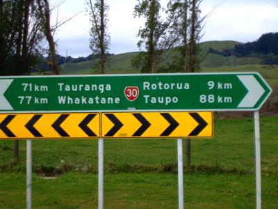
If you don't have internet access or GPS in your car or on your phone you will need a map. There are plenty of good driving maps available at petrol stations and book stores throughout New Zealand.
RTS TIP - Something is always happening on the highways so check out New Zealand highway info before you begin your journey.
Usually I will print off or jot down driving directions from Google before I leave on any journeys I take. I know, very old school. :)
On
the whole, roads in New Zealand tend to be pretty well signposted so
you shouldn't have too much trouble. Actually, I quite like getting
lost, you never know where you'll end up.
Google Driving Directions Map
On my Google driving directions map you will see that there are six highways converging around Lake Rotorua and on into Rotorua itself. The yellow star markers will give some of the information outlined below if clicked.
I will explain a little about each highway as if you are leaving Rotorua - easier for my brain. Working clockwise from the top left-handside of the map:
1) SH5 is the main route out of Rotorua heading both north and south. In this instance it's northwards. It links up with SH 1 (just before Tirau - lots of little craft and antique shops) which runs the length of New Zealand towards Auckland and on up north.
The quaint rural township of Cambridge, about an hour from Rotorua, is well worth a side visit just to see the heritage buildings, villas, and tree-lined streets. It has an old English feel about it. Also, lots of cool coffee shops. Cambridge can be accessed via an off-ramp. Driving through Cambridge links back onto SH1.
2) SH36
takes you to Tauranga and Mount Maunganui. This is the back road used by a
lot of locals from both ends. It passes through gorges so some steep,
winding parts are a given. By winding I mean corners that have 35kmp (21.7mph)
signs.
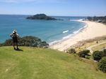
Mount Maunganui is THE beach to go to in the summer for locals and visitors alike. The little township itself is tiny so it gets packed.
You would probably want to avoid it on New Years Eve as this is one of the hot spots descended on by teenagers from all over.
3) SH33 is the main route to Tauranga or Mt Maunganui. It gets a lot of traffic as in logging trucks and commercial vehicles going to the Port of Tauranga.
The road changes to SH2 and a Toll Road not far past Paengaroa. You can avoid the tolls by taking a left at the large roundabout you come to which passes through Te Puke and eventually links up again with SH2. This used to be the main highway.
If you make a right-hand turn at the same roundabout, you will be taken to the beach communities of Maketu (where the Te Arawa people first landed), Pukehina, Matata and on to Whakatane, Ohope and Opotiki, all well signposted.
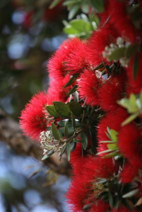
It's a lovely drive along this coastline. Watch out for the Pohutukawa (New Zealand Christmas) trees, especially when they are flowering.
4) SH30 will take you past the beautiful lakes of Rotoiti, Rotoehu and Rotoma where you will find walks, trout fishing and camping grounds. Great for holidays.This highway also goes to Whakatane and on to Ohope (yay, love that beach) and right out to the eastern coast of New Zealand where a lot of sea fishing and hunting take place.
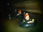
5) SH30 again but heading south of Rotorua. Once you pass through the major roundabout by Te Puia, it's only a few hundred metres to a right-hand turn at which SH 30 continues. It eventually links up with SH1 heading south. This way also takes you to Tokoroa, Te Kuiti, and Waitomo Caves (blackwater rafting).
IMPORTANT: If you want to enter any Māori place name into Google Maps make sure you have the correct spelling or you could travel far off-course. Eg. Manukau, Auckland - Manakau, near Wellington
6.SH5 Heading south in this instance. If you don't take take route SH30, the highway becomes SH5. Waimangu and Waiotapu thermal parks, Kerosene Creek and Hot'n'Cold free thermal swims, and Rainbow Mountain are located on this route. There's also a left-hand turn onto SH38 which heads to the east coast and Te Ureweras.
SH5 is the highway we normally head south on. It joins up with SH1 just before Taupo (trout fishing, volcanic activity). As SH1 now bypasses Taupo it requires a side-trip to take in Taupo and Huka Falls.
Huka Falls is a must see on the way to Taupo. Sparkling clear water powers through a narrow channel. I always get a sense of how small I am when I make time to visit the falls. You can always stop off at Taupo and take a walk along the lakefront of Lake Taupo, grab a bit to eat maybe, then continue south to link up with SH1 again.
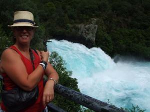 My sister-in-law Jo at Huka Falls on the way to Taupo
From Taupo the south spreads out in all its glory. Just on the other side of Taupo a left turn can be made to go to Napier, Gisborne, Hastings and Wairoa.
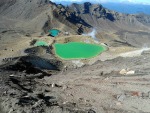
SH1 takes you through Turangi and the Tongariro National Park where there are three active volcanoes. They are Tongariro (1967m), Ruapehu (2797m) and Ngaruhoe (2291m). If you get a clear day, views of the mountains from the Desert Rd (still SH1) are spectacular. As the name Desert Road implies, it is a barren, desolate area for miles upon miles.
A right-hand turn just south of Turangi onto SH41 followed by SH47 takes you to the mountains for the Tongariro Crossing walk and skiing. The Whakapapa ski field is located on the north-western slopes of Mt Ruapehu. Turoa ski field is on the south-western slopes. There are lots of walks and hikes you can take around the area.
Don't be surprised if you see wild horses on the roadside. They are part of the Kaimanawa herd managed by Kaimanawa Heritage Horses Inc. Society, made up of volunteers. The volunteers and Department of Conservation (DOC) take care of the management and welfare of the horses. Donations help to train and find homes for the horses when culling has to take place in order to keep the numbers down.
The drive continues south to Wellington with quite a few towns passed through.
I hope I haven't made that too confusing. I find it quite hard trying to explain directions clearly. If it helps in your travel planning without getting you too lost, it's all good. If you have any questions use my contact form.
